Kirkjubæjarklaustur
The road to the Laki craters turns off some twenty kilometres before
Kirkjubæjarklaustur. You need a four-wheel drive to go far down
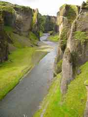
that, but the Fjarðrargljúfur canyon is only a short distance away and
accessible with a normal vehicle. The canyon is wide and flat, and if
we'd had more time and been prepared to wade, it looked like a pleasant
walk up the river-bed. Instead we followed the track along the top of
the canyon, which gave us a good view of the gnarled pinnacles and rock
formations that flank it. It was a very peaceful place, and we had it
all to ourselves - a tour group was leaving just as we arrived.
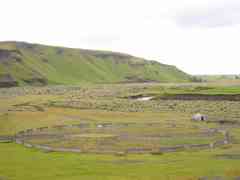
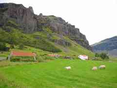
The nearby farm also had a round sheep pen.
Laki: one of the things I regretted not
being able to fit into this trip was the bus tour to the Lakigígar crater
row, produced by the catastrophic eruption of Laki in 1783. Run by BSI,
the Laki tour leaves Kirkjubæjarklaustur at 9am and returns at 6.30pm,
so it would have taken up a whole day... It would have been nice to
have had more time to look around Kirkjubæjarklaustur too, rather than
rushing through.
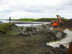
Just outside Kirkjubæjarklaustur, the road had been washed away and was
being rebuilt, with a temporary embankment carrying traffic. We stopped
in the service station for a hotdog and coffee, and Camilla bought
some gifts from a handicrafts store. We then went upstream a little to
look at Systrastapi (the Sisters' Pillar) and the waterfall Systrafoss.
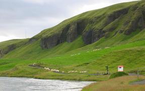
A couple was herding sheep towards us, which I unfortunately startled
before we turned around and got out of the way.
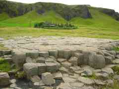
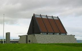
Attractions inside Kirkjubæjarklaustur include Kirkjugólf, a platform
of hexagonal basalt rocks which really does look like the foundations
of a building, and the Steingrímsson memorial chapel, named after the
pastor whose sermon supposedly saved the town from lava in 1783.
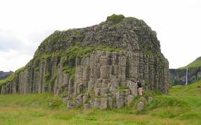
Heading from Kirkjubæjarklaustur towards Skaftafell, we stopped at
Foss á Sidhu to look at the basalt columns of Dverghamrar, the dwarf
cliffs, and then at Núpsstaður, where the farm has an old turf church.
Looming over the region is the near 800m high peak Lómagnúpur.
Then it was a long straight road across the Skedðarársandur, a real
desert, with views of the Skeiðarájökull glacier on the left. Much of
the road is on huge long bridges.
Next: Skaftafell - Svartifoss
Previous: Vik i Myrdal + the Mýrdalssandur
[Alternative spellings: Kirkjubaejarklaustur, Fjardrargljufur, Steingrimsson, Kirkjugolf, Nupsstadur, Lakigigar, Lomagnupur]
