Fimmvörðuháls Pass
It's not that far from the Baldvinsskali hut to the pass - maybe a
kilometre and a half - but there's a bit of climbing to do and an
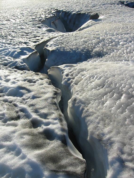
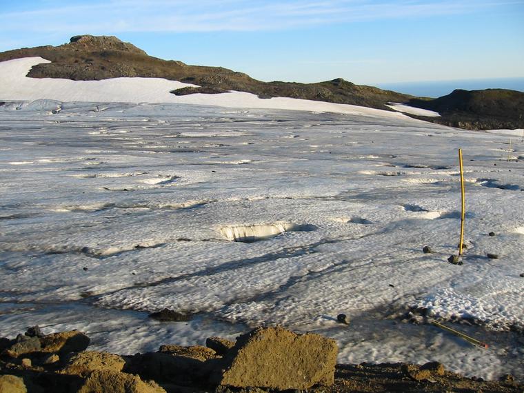
icefield to cross. This is probably a snow field most of the time,
but at the end of an exceptionally hot summer it was largely ice, and
full of holes...
It's a short climb from the other side up to the pass. From there the
main track continues towards Þórsmörk, but we turned off to the west,
heading for the hut Fimmvörðuskali. Unfortunately we had to cross
a stream and the ice bridge that the track normally used had broken.
We clambered down and along the bank, but I was beginning to get a bit
worried - it was getting dark - when another walker half-fell down
the slope to meet us. It was Anka, a young German hiker.
Someone came running down on the other bank, and shouting backwards and
forwards in German established that a) we had to continue upstream to
cross and b) the hut was full - a tour group had booked it. We were not
very happy to hear this, but the guy on the other side kindly went up
to check if they'd let us stay, and after ten minutes or so came back
to say it was ok.
So we walked upstream a few hundred metres, took off our shoes, and
waded across - maybe 20cm at the deepest, but damn cold. After drying
off our feet and reshoeing ourselves, we climbed up to the hut.
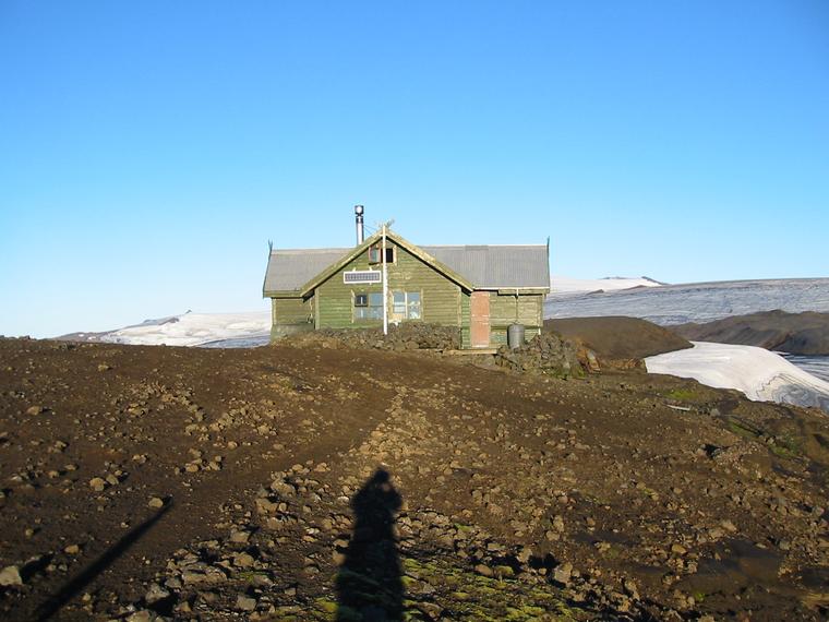
I was expecting a bigger hut, but Fimmvörðuskali turned out to be smaller
than Baldvinsskali. It was nicely put together, however, with proper
bunks, a gas stove, etc. (the tap didn't work but there was a water tank
outside) - just very crowded with a tour group of some twenty Germans
plus extras!
Anka wasn't part of the group - she was near the end of a six week
solo hike from the northernmost point of (main island) Iceland to the
southernmost. Much of that she'd spent in the interior all by herself,
so she was happy to talk.
Wednesday 27th August
We were up early - we wanted to make sure we reached Þórsmörk in time
for the 3.30pm bus! - along with Anka, who was heading for Skógar.
But we spent nearly an hour packing, having breakfast, and admiring the
near-360-degree views from the hut, before we set off around 7.30am.
Crossing the stream that had baulked us the previous evening was easy -
being morning, it was dry!
Soon after this the clouds began to roll in from the south, but we were
walking away from them and the light cloud that followed us wasn't enough
to spoil the views.
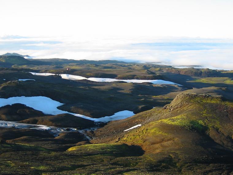
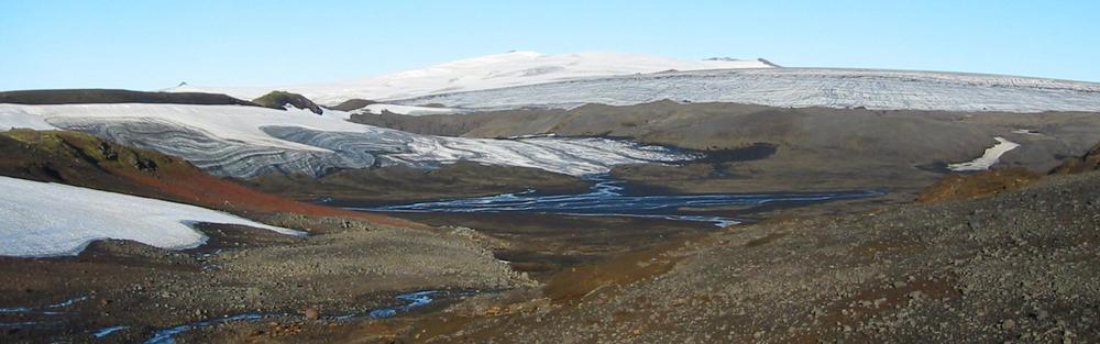
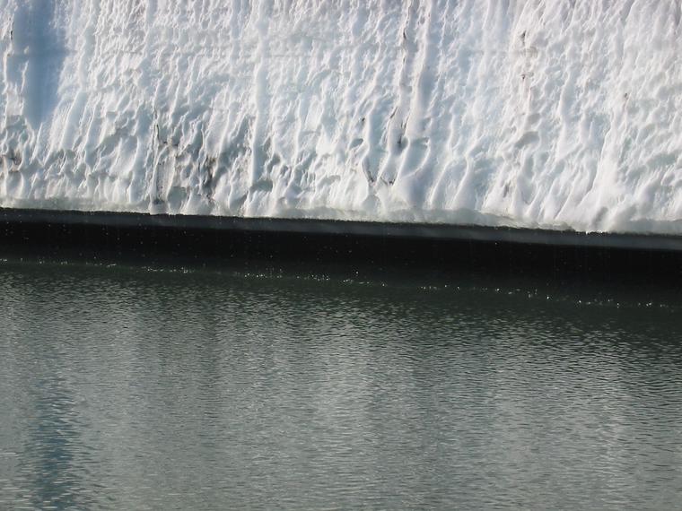
A decent-sized lake made a dramatic contrast to the near-desert surrounds;
where the ice-sheet met the lake was a continuous line of drips. We then
pushed on over the stony hills towards Þórsmörk.
Next: Þórsmörk (Thorsmork)
Previous: Skóga waterfalls
[Alternative spellings: Fimmvorduskali, Fimmvorduhals, Eyjafjallajokull, Thorsmork, Skogar]