Þórsmörk (Thorsmork)
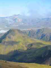
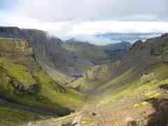
Leaving the flatter region around Fimmvörðuháls Pass, there opened
out before us the dramatic view over Goðaland - "land of the Gods" -
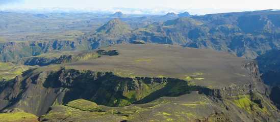
and Þórsmörk - "the woods of Thor". In the foreground were the peak
Utigönguhöfði and the plateau Morinsheiði, behind that were rugged
valleys and serried volcano-shaped peaks. It was very Tolkienesque.
There was a little bit of cloud, but it came and went and probably
enhanced the views more than it detracted from them.
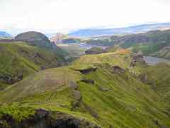
We made our way down pebbly hillsides and negotiated the saddle across
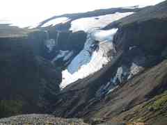
to Morinsheiði, on top of which is a barren stony desert. Looking back
on either side were views of waterfalls and glaciers.
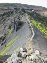
Descending the other side, we continued down the convoluted and
sometimes knife-edge ridge Strákagil towards the valley floor. It got
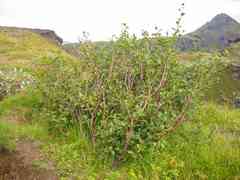
progressively greener as we descended: the first tree was a notable
event, and further down it was almost a forest. And there was an amazing
variety of large fungi that demanded photographing - see the separate flora page for some photos.
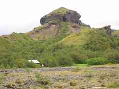
Camilla was pleased to find a toilet when we reached the flat floodplain;
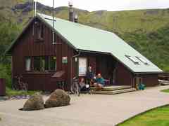
it was then only a short distance to the hut Basar, which we reached
at 1pm. We'd started the trip thinking we had to reach the further hut
Husadalur by 3.30pm, but had then been told by people we passed that the
bus came to Basar at 1.30 - and the hut warden reassured us that that was
the case, so we had just enough time for our usual ryvita and tuna lunch.
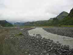
The river Krossá looks innocuous, but despite the flatness of the valley
and the widely spread braided streams, it's fast-moving and dangerous.
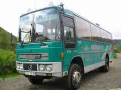
Some sections were quite exciting even in the four-wheel-drive bus,
though the driver obviously knew the route very well. Half way across
we picked up a young German woman who had foolishly taken off her boots
and tried to walk across barefoot - her feet were bruised and bleeding
and she was in a bad way.
The bus went around the long way to Husadalur, where it would wait
until 3.30pm before leaving, so we left our packs with it and took the
opportunity to do the easy (touristy) walk through the woods to meet
it there. It started raining near the end, and we were glad to reach
the cafe and have hot chocolates. (Þórsmörk is a popular weekend outing
from Reykjavik and Husadalur is a small complex of buildings rather than
a hut.)
Landmannalaugar to Þórsmörk:
The amazing thing is that, fantastic as it is, the two day walk we had
just done is usually an optional "extra" added onto the four day walk from
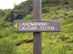
Landmannalaugar to Þórsmörk, which is the best known walk in Iceland.
That must be pretty spectacular, and I plan to come back and do it one day.
The bus from Þórsmörk was almost full. The bus driver
gave us a bit of commentary on the landscape: a glacial tongue of the
Eyjafjallajökull icecap and its terminal lake, the "little demon" and
"big demon" hills standing above the Markarfljót floodplain, Canyon River falls and Seljalandsfoss.
Reaching the coast there was a view of the Vestmannaeyjar islands, which
as a result of some strange optical effect looked really close.
Getting off at Hvolsvöllur, we had some time before the bus for Skógar
arrived. We failed to find the Saga Centre (which would have been shut
anyway) but stocked up on food in the supermarket and had dinner in the
service station restaurant - sharing lamb cutlets, soup, coffee, and
a soft drink set us back 1700 króna.
When the bus dropped us off at Skógar in light rain, we were glad to
see our little car again - and who should we run into setting up camp
but Anka! She was soaked and had had a damp day walking down the Skóga.
Next: Vik i Myrdal + the Mýrdalssandur
Previous: Fimmvörðuháls Pass
[Alternative spellings: Thorsmork, Fimmvorduhals, Krossa]
