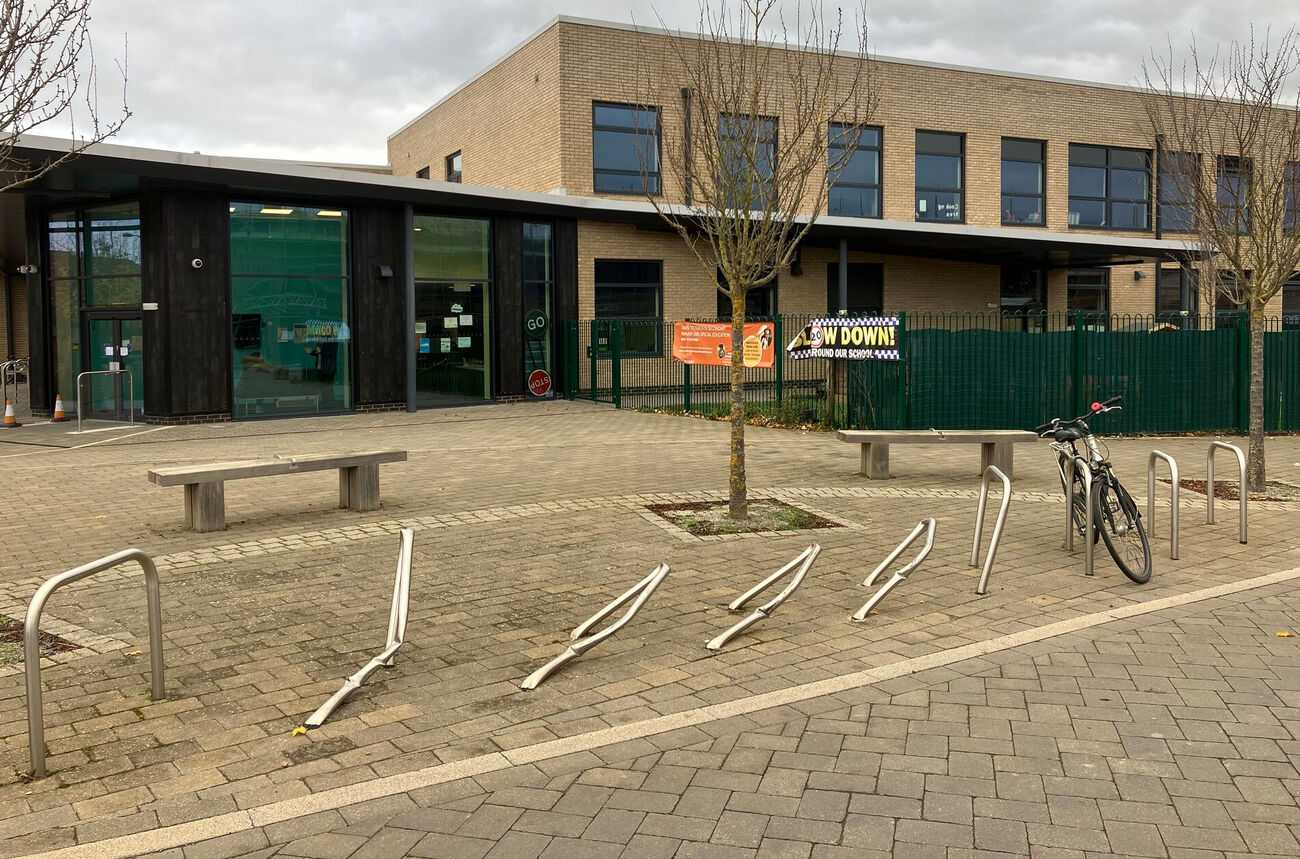
There have been concerns about road danger on Barton Fields Rd, the spine road that runs through the Barton Park development on the eastern outskirts of Oxford, in particular around the primary school. One driver ploughed into the cycle parking stands outside the school, another hit one of the buildings under construction on the other side of the street, and there are a lot of other incidents that don't show up in the official road injury record. (There are also concerns about road danger at the crossing of the A40; I have written about those elsewhere.)
In response to this, measurements were carried out by the county, finding that the road carries an average of 2550 motor vehicles daily, with an average speed of 23mph and an 85th percentile speeed of 28mph. The officers conclude:
"Applying the guidance in the Department for Transport LTN 1/20 (cycle standards) and the Road Safety GB Assessment of School Walking Route guidelines, the current flow of around 2500 vehicles per day would be classed as comparatively light, and suitable for active travel without the need for segregated cycle provision or controlled pedestrian crossings etc., although lower cost measures such as cycle symbols could usefully be provided."
But this is not actually true. LTN 1/20 "Cycle Infrastructure Design" says that mixing cycling with motor traffic at 20mph is "provision suitable for most people" with traffic volumes up to 2500 motor vehicles per day. But the speed profile of Barton Fields Rd is significantly higher than that of a traffic calmed 20mph street, and indeed would be consistent with a 30mph speed limit. And 2550 motor vehicles a day is more than 2500. (Yes, it is only marginally more and nothing qualitative changes at 2500 motor vehicle per day, but, conversely, even 2450 motor vehicles per day will deter significant numbers of people from cycling and is only marginally acceptable. Oxfordshire County Council prides itself on its support for active travel and should not be doing the bare minimum suggested by guidance, let alone slightly less.)
There is also the problem that much of the housing in Barton Park is not yet occupied or even built, and that will bring significantly more motor traffic.
The School Walking Route guidelines talk about "sufficient gaps in the traffic flow and sight lines to allow enough opportunities to cross safely" but don't link that to specific combinations of speed and traffic volume. Some analyses suggest that the slowest and most vulnerable users — people with disabilities, older people, adults walking with toddlers, wheelchair and walking-frame users, and so forth — start to find crossing roads stressful when traffic volumes exceed 120 vehicles an hour in peak, which would be around 1200 per day.
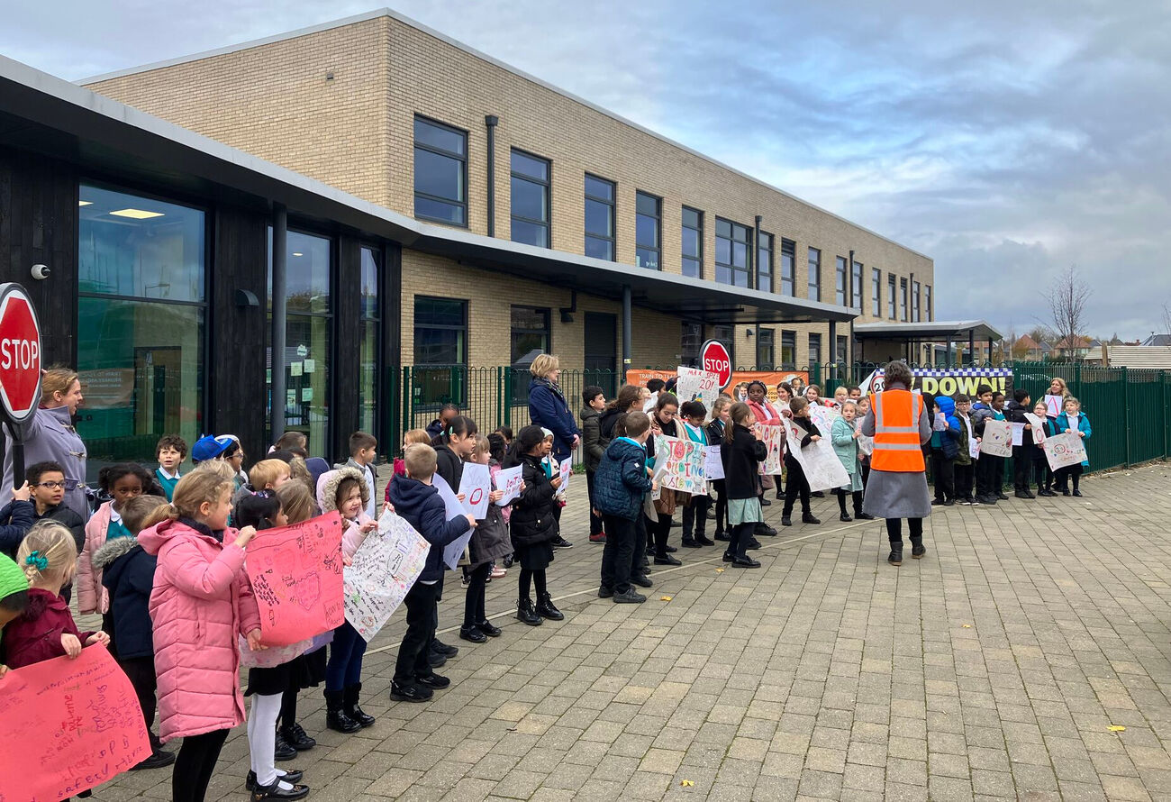
Theory and standards aside, that many parents will not let their children cycle on Barton Fields Rd, or walk to school unaccompanied, suggests a clear failure to provide for inclusive walking and cycling.
The county's narrow focus on (reported) injuries is also misleading. Inhibiting people from walking or cycling at all avoids collisions and injuries but undermines the broader transport goals of the county - most obviously its targets for car trips and cycling trips - and contributes to several major public health problems created by physical inactivity. Barton Fields Rd is an essential route for residents, to the primary school or shops but also into the city or towards Barton, and also a key through route, for people from Barton cycling to Northway or Marston, for example.
What can be done?
We may have established that there is a need to make Barton Fields Rd safer and more accessible for walking and cycling, but that doesn't solve the problem of how that should be done. A fundamental physical constraint is that there simply isn't the space to retrofit the road with separate cycle infrastructure. Putting in formal pedestrian crossings might be possible, but would be expensive. (Two additional constraints are that the road is unadopted and that there is no funding.)
Which means as much as possible must be done to keep traffic volumes down and traffic speeds low.
The single most important measure is to keep motor traffic volumes as low as possible. To do this, there needs to be a bus gate in between Barton Park and Barton. That would isolate the traffic problem to Barton Park itself, and stop the Land North of Bayswater Brook development pushing further through traffic onto Barton Fields Rd. It might also deter "race track" use of Barton Fields Rd. (It may be possible to avoid the "adoption" problem by situating this outside the development boundary.)
Addressing the safety and access issues at the A40 crossing would enable some people to walk or cycle some trips instead of driving, as would (a positive feedback loop) making Barton Fields Rd safer and more accessible. Faster buses into town (perhaps from the traffic filters) might shift some people from driving to catching the bus. And so forth. But these are all going to have relatively small effects on traffic volumes.
To keep traffic speeds low there are several options. Barton Fields Rd is 5.5 metres across, which is already at the minimum for two-way bus operation. But chicanes could be used to create pinch points to slow traffic. The absence of on-street parking would allow these to be safely combined with cycle bypasses - perhaps 3m for general traffic, a 1.5 metre bypass for cycling, and 1m for a planter or other divider separating those and implementing the chicane. (The chicane would have priority for traffic in the opposite direction to the cycle bypass.) Another option would be to make the road feel narrower, by moving e.g. bollards to the edge of the carriageway.
Vertical deflection (speed humps) is also a possibility, possibly combined with the chicanes. And painting cycle symbols a quarter and three-quarters of the way across the carriageway would alert drivers to the likely presence of people cycling and encourage people cycling to do so more centrally in the carriageway. (Given the road width, it should be clear to people driving not to overtake cycles if traffic is coming the other way, but unfortunately they do anyway on roads like this.)
None of these schemes are hugely expensive (a bus gate camera would be moderately expensive, chicanes are cheap) - and could be paid for either by the developers now (if some pressure is put on them) or by the county after adoption.
But perhaps the most important action the county needs to take is to make sure it doesn't sign off (in its position as a statutory consultee on transport) on further developments with spine roads like this. Any development where the volume of motor traffic is likely to go above 2000mv/day needs to include separate cycle tracks and proper pedestrian crossings — and that threshold should probably be lower on bus routes, where traffic calming measures such as speed humps and reducing forward visibility may not be appropriate and where stopping buses create additional hazards. (The proposed Land North of Bayswater Brook development has separate cycle tracks alongside its spine road, with crossings on raised tables.)