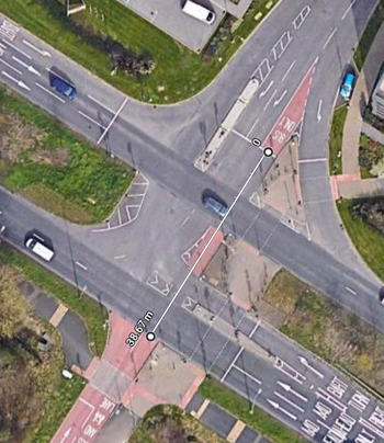
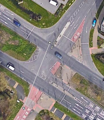
It is 39 metres across the Barton Park junction cycling from Barton Park to Northway, and 46 metres going the other way, measuring the distance from the stop line to the edge of the far-side A40 traffic lane. Analysis of the signal timings reveals that the time allocated for crossing this - the "intergreen" between the green light for buses and cycles ending and the green light for motor traffic on the A40 starting - is the same in both directions, just 8 seconds.
more
Parks Rd is a key north-south cycling route through the city centre, as well as part of National Cycle Network route 51, and its junction with South Parks Rd is currently the worst bit of that route. People cycling north are expected not only to share a section of road with high volume traffic flows but to perform an uncontrolled right turn across that traffic; people cycling south are forced to join the main motor traffic flow with no support at all.
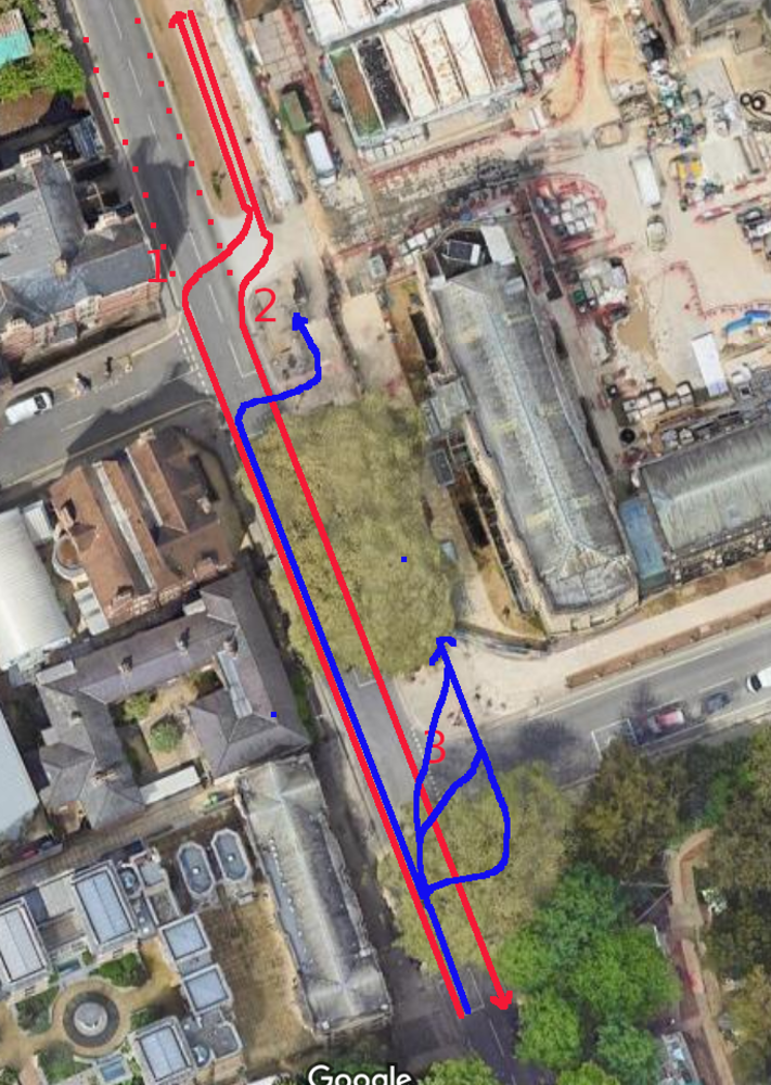
the approved/legal movements are in red and the actual ones (using the pedestrian crossings) are in blue - alternatively, people avoid using the cycle track at all (dashed red)
more
I think consideration should be given to turning off the signals at the northern end of Cornmarket and having that junction operate like the Holywell junction at the other end of Broad St.
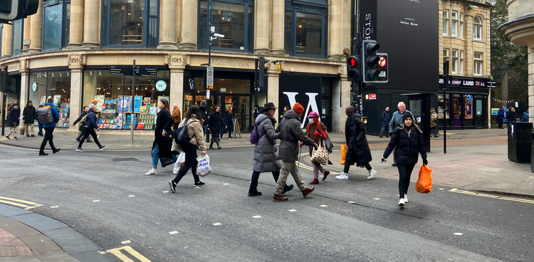
I walk and cycle through this junction regularly, and there's pretty much always:
- a stream of pedestrians crossing on red across George St, as in the photo above - if they didn't they'd pile up and block the footways;
- pedestrians crossing haphazardly across the unsignalled Magdalen St West and Broad St arms, sometimes getting caught out mid-crossing by signal changes;
- mopeds and cycles going through red lights or using the wrong side of the road to turn from Broad St into Magdalen St West; and
- significant periods when buses and taxis and cycles are waiting even though the junction is clear.
more
The junction of Longwall St and High St, in Oxford, poses some unusual design challenges. Along with Magdalen Bridge and the Plain roundabout, it is a key bottleneck in Oxford's transport network — this segment is probably the second busiest cycle route in the UK and likely the second busiest bus route. There are huge problems with this junction as it is, but the core schemes in the forthcoming Central Oxfordshire Transport Strategy offer a chance to redesign it.
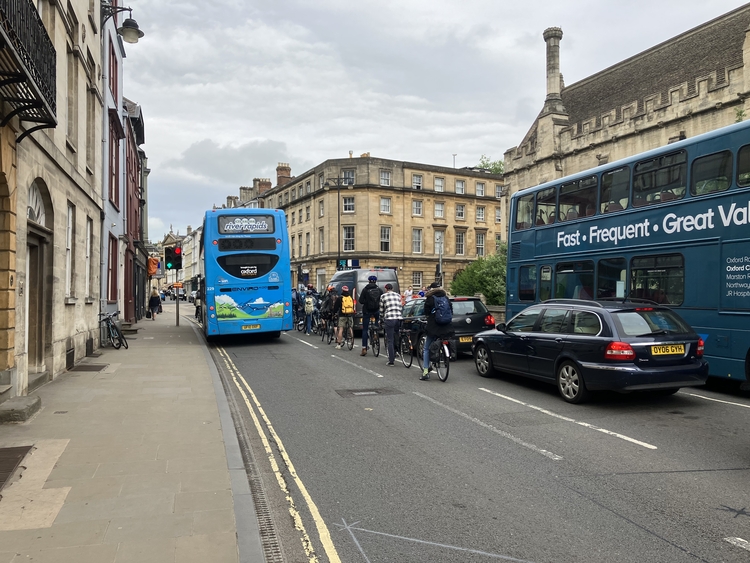
people cycling wanting to turn right into Longwall have to wait in a one metre wide lane with motor traffic on both sides
more
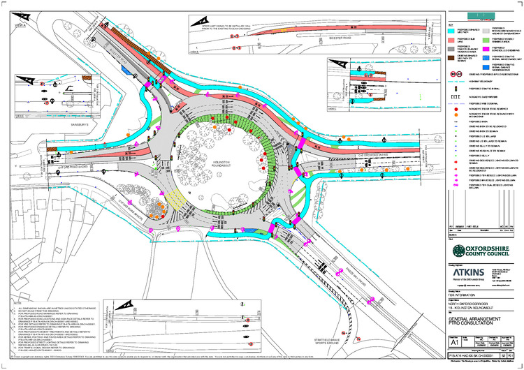
The plans for redesigning the roundabout south of Kidlington are inconsistent with both the county's headline car-trip reduction targets, its active travel goals, and its Vision Zero commitment.
Update: the design was completely reworked in 2023, and the resulting roundabout is one of Oxfordshire's active travel success stories.
more
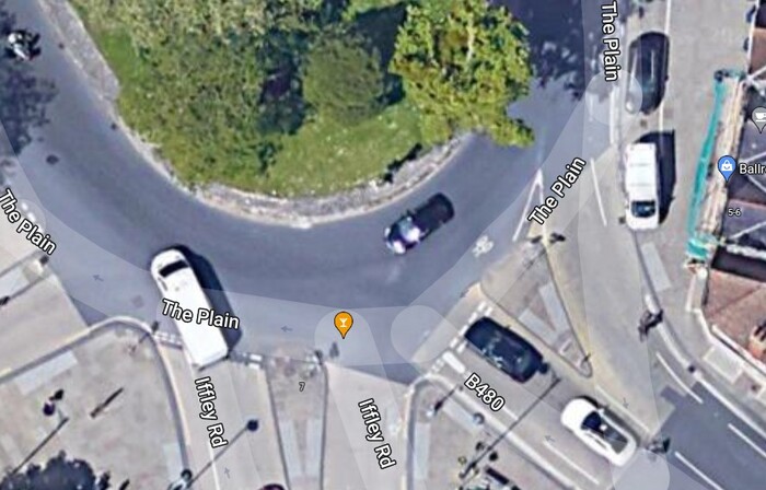
There are some relatively easy changes that would make cycling safer at the Plain — ones that can be implemented without engineering works.
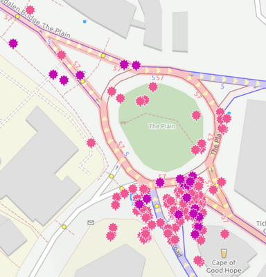
Angle or stagger the give-way line on the Cowley Rd entry, so people on cycles don't have their view of approaching vehicles on the roundabout obscured by motor vehicles on their right. (Compare the give way lines on Iffley and Cowley Rd in the Google satellite image.) By far the largest concentration of reported collisions involve cars or cycles entering the Plain from Cowley Rd.
more
Two terrible deaths within a month have brought cycling safety to the fore, but the problems are not new and the Plain in particular has been a worry for a long time. Safety was the rationale behind the rebuild of the Plain in 2016 (which made things slightly worse), I used it as an example of junction design that failed to address walking and cycling safety and accessibility, and I tweeted about it just two weeks before the fatality.
Unfortunately there are no easy solutions, at the Plain or elsewhere in Oxford. Indeed I would argue that there are no significant improvements that aren't either very expensive or a long way from being Pareto (making no one worse off): witness the unhappiness about the parking removal in the Quickways and the modal filtering in the low traffic neighbourhoods. more
Consider the junction where the B4495 (Church Cowley Rd) meets the A4158 (Henley Avenue/Rose Hill). Is this the worst junction in Oxford? more
One way to see how little consideration walking and cycling are given in Oxford is to look at the main road junctions. So stealthily and incrementally, over decades, have time and space at these been reallocated to motor traffic, at the expense of other modes, that people have become habituated to it and are mostly oblivious to how bad they are. We need all of Oxford's junctions rebuilt to prioritise walking and cycling safety and accessibility over motor traffic throughput.
The three examples I use here are chosen because I know them, but a similar analysis would hold for most of the major junctions in Oxford. more
In this post I examine a "micro" example from East Oxford that illustrates how street design fails people walking or cycling: where the lane from Boundary Brook Rd meets Howard St. more
A dual network strategy for cycling would only make sense if we had a bimodal population of cyclists. To illustrate this, consider Frideswide Square, where the planners are clearly picturing something like this.
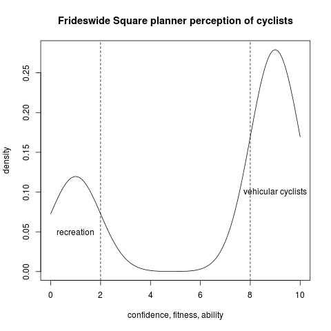
On the one hand, the bulk of cyclists are expected to be vehicular cyclists, confident enough to take primary position going around the roundabouts and happy to cycle in dense 20mph traffic flows. Alternatively cyclists are allowed to use the pavement, mixing it with pedestrians with no segregation — the planners seem to be envisioning a small number of families on Sunday outings with children, happy to meander around pedestrians at 5mph and not needing to actually get to or from Fridewide Square. more

