The Oslo Street Design Manual (in English) is useful. In particular, it has guidance for cycling infrastructure provision in the presence of hills, which is lacking from Dutch guidelines and standards.
But a very important flowchart, for determining what cycling infrastructure is needed in different circumstances, has two errors in it!
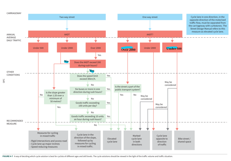
the key flowchart, with corrections
While the county should continue to support schemes for schools that request them, having that as the only way for schemes to happen will limit the effectiveness of the program. The county should proactively plan School Streets schemes at those locations where they will have the most effect. more
Oxfordshire's cabinet recently adopted a "decide and provide" approach for transport planning, but that doesn't seem to be informing the plans for the traffic filters in the Central Oxfordshire Travel Plan. The St Cross traffic filter and cycling on Magdalen Bridge provides one example of this. more
The junction of Longwall St and High St, in Oxford, poses some unusual design challenges. Along with Magdalen Bridge and the Plain roundabout, it is a key bottleneck in Oxford's transport network — this segment is probably the second busiest cycle route in the UK and likely the second busiest bus route. There are huge problems with this junction as it is, but the core schemes in the forthcoming Central Oxfordshire Transport Strategy offer a chance to redesign it.
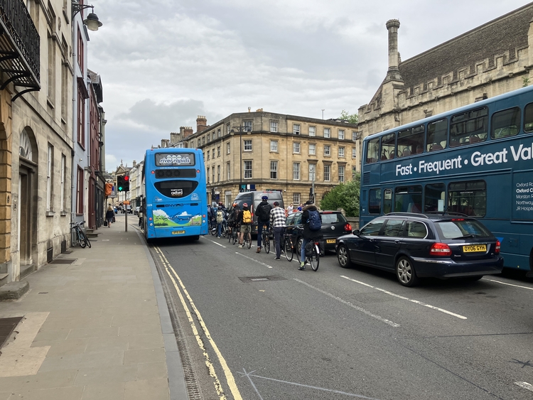
people cycling wanting to turn right into Longwall have to wait in a one metre wide lane with motor traffic on both sides
more
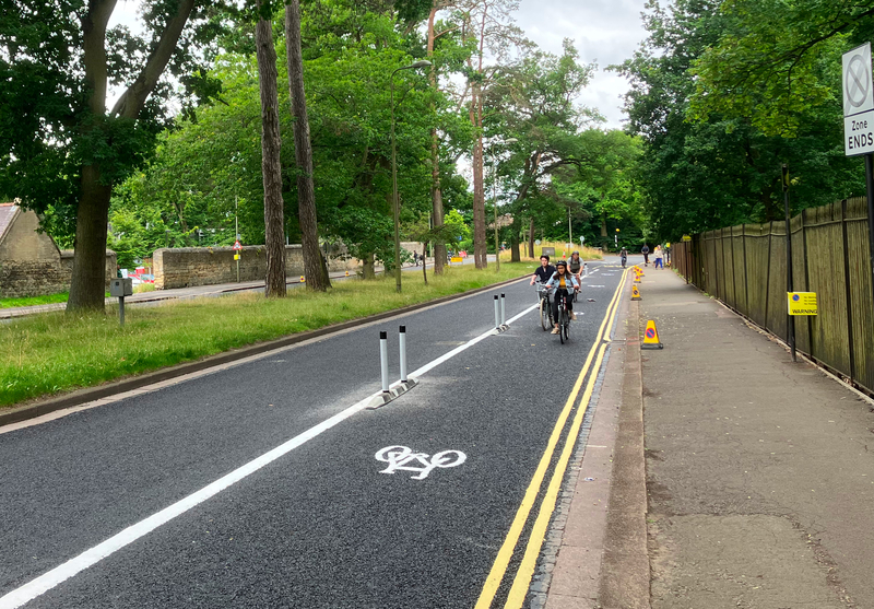
A look at the new Warneford Lane cycle tracks, put in in 4-7 July 2022.
more
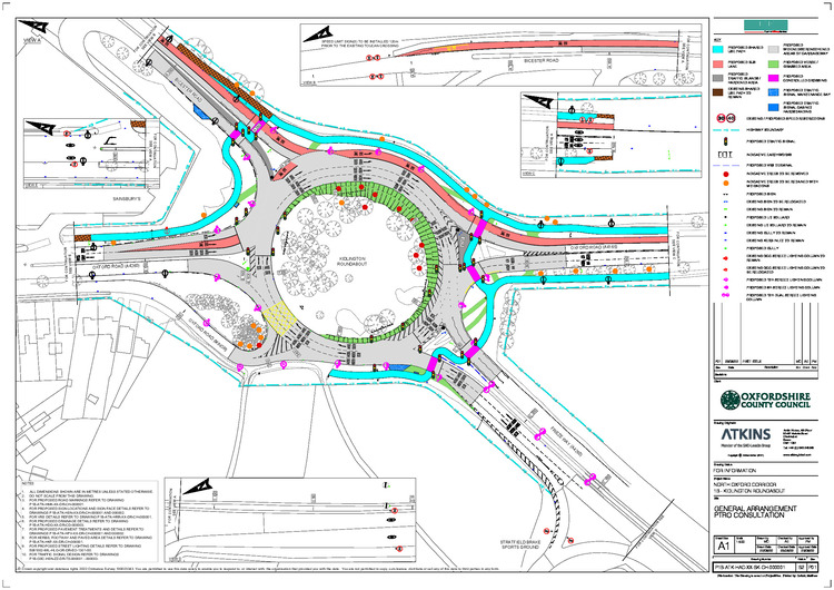
The plans for redesigning the roundabout south of Kidlington are inconsistent with both the county's headline car-trip reduction targets, its active travel goals, and its Vision Zero commitment.
Update: the design was completely reworked in 2023, and the resulting roundabout is one of Oxfordshire's active travel success stories.
more
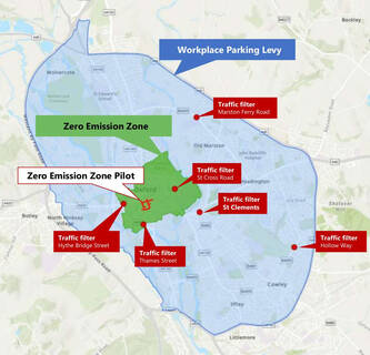
How should the planned Oxford traffic filters work: what hours should they operate, what exemptions should there be, and so forth? To understand this, we need to understand their purposes:
- to allow space and time to be reallocated to make walking and cycling safe and accessible, especially at junctions
- to stop buses being congested and delayed, to have better and more efficient bus services
- to free up space (and reduce noise and air pollution) for an improved public realm
But while the goals may be the same, the unique geography of each filter — and the very different roads they are on — means that they may need quite different implementations. This can be illustrated by Hythe Bridge St and Marston Ferry Rd. more
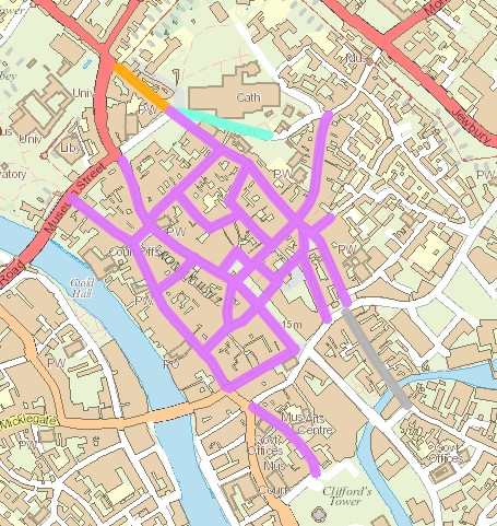
Based on a four day visit to York, I think its city centre should be a model for Oxford's. York has pedestrianised a huge chunk of its centre, and it's really great to walk around. After a bit it just feels entirely normal, just as it does in similarly pedestrianised European cities, and it really shows up just how horrible walking around central Oxford is.
At least during the daytime, outside loading hours, there are no cars at all, moving or parked in the core area of York. This means that one never has to think about traffic at all, or even about getting around parked cars, which makes for a completely different feel to bits of Oxford such as Catte St or Turl St or New Inn Hall St or Merton St or Pembroke St, where anyone walking is likely to encounter at least one moving motor vehicle and many parked ones. more
There are some relatively easy changes that would make cycling safer at the Plain — ones that can be implemented without engineering works.
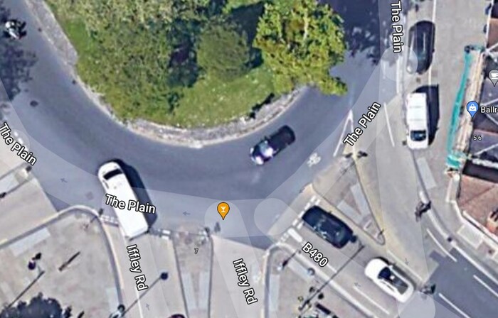
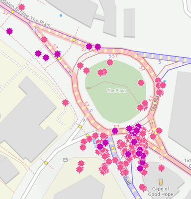
Angle or stagger the give-way line on the Cowley Rd entry, so people on cycles don't have their view of approaching vehicles on the roundabout obscured by motor vehicles on their right. (Compare the give way lines on Iffley and Cowley Rd in the Google satellite image.) By far the largest concentration of reported collisions involve cars or cycles entering the Plain from Cowley Rd.
more
Two terrible deaths within a month have brought cycling safety to the fore, but the problems are not new and the Plain in particular has been a worry for a long time. Safety was the rationale behind the rebuild of the Plain in 2016 (which made things slightly worse), I used it as an example of junction design that failed to address walking and cycling safety and accessibility, and I tweeted about it just two weeks before the fatality.
Unfortunately there are no easy solutions, at the Plain or elsewhere in Oxford. Indeed I would argue that there are no significant improvements that aren't either very expensive or a long way from being Pareto (making no one worse off): witness the unhappiness about the parking removal in the Quickways and the modal filtering in the low traffic neighbourhoods. more
Oxfordshire is still colouring bus lanes - as this newly surfaced example from just north of Folly Bridge shows - while refusing to paint cycle lanes. This prioritises helping a few inattentive or blind drivers avoid fines over safety for people cycling.
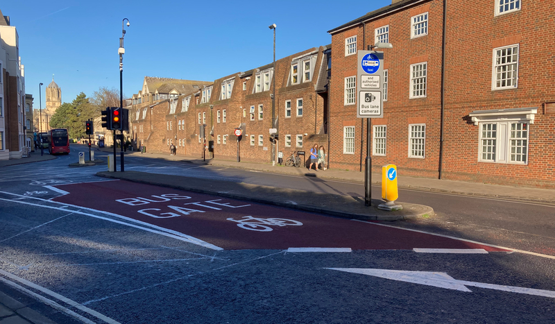
the "bus gate" approaching St Aldates from Folly Bridge
more
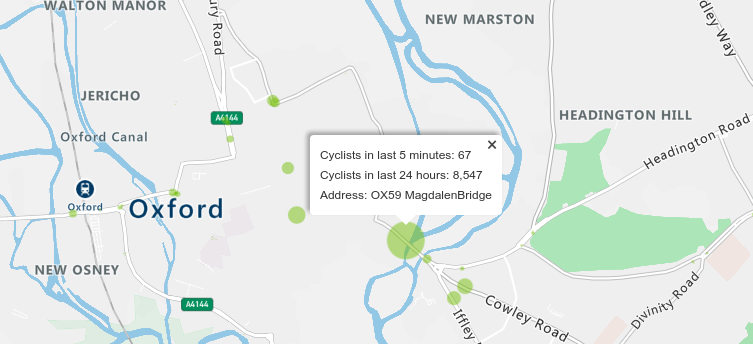
Oxford's Magdalen Bridge is plausibly the second busiest cycle route and the busiest bus route in the United Kingdom; it is also a major pedestrian route. It is probably the most critical link in the city's transport system.
more
Connecting Oxford is absolutely central to Oxford's transport future. The new county government had been quiet about it until recently, but has made a clear commitment to it in the last few months. It is unclear how much of the details on the old web site are still current, but some of my thoughts on how to prepare for Connecting Oxford follow.
The Local Transport and Connectivity Plan (LTCP) adopted in October 2021 said:
"Work on aspects of Connecting Oxford has already started. The aim is to have the workplace parking levy and traffic filters in place from 2023."
And the lead request for funding in the Bus Services Improvement Plan (BSIP) is for the traffic filters in Connecting Oxford. more
The designs proposed for Woodstock Rd will be a huge improvement for walking and cycling.

The cycling provision will be taken off pavements, allowing for 2 metre wide footways. At some minor side entries there will be fully continuous pavements giving people walking unquestionable priority. Turning radii at side entries will be tightened, shortening crossing distances and slowing motor traffic. And five additional signalled crossings are planned.
If this scheme goes ahead as designed, Woodstock Rd will have the best cycling provision on any Oxford arterial route. It is not clear from the plans, but if I understand rightly the scheme involves stepped cycle tracks. These will be 2.2m wide for most of the route, will have clear priority over side entries, and will bypass bus stops, avoiding forced rejoins with the carriageway. The fundamental change is that cycling is now neither on the carriageway nor on the pavement, but given full recognition in its own right.
It's not perfect. Due to space limitations, there are places where the pavement is under 2m wide — 1.8m at the narrowest — and there's a fairly long stretch where the cycle track is only 1.7m wide. (The pavements have been prioritised here, only dropping below 2m when necessary to stop cycle tracks being narrower than 1.7m.) There are also a few "shared space" sections, due to constrained space around bus stops, to support less confident people cycling across Woodstock Rd, and (probably) to avoid having to remove trees. more
Oxford's "Quickways" schemes may make cycling some trips faster for some people, but the biggest gains from them will be making cycling safer and more accessible. I will cycle some routes more slowly if these schemes are implemented!
So "Quickways" is a misnomer — "Saferways" would be much better. My previous post about these schemes focused on technical details. Here I want to focus on the basic road safety argument for them. more
Oxfordshire County Council has proposed a range of "Quickways" measures designed to improve cycling on some of Oxford's main roads — Iffley Rd, Cowley Rd, Marston Rd, Between Towns Rd, Morrell Av, Warneford Lane, Parks Rd, Banbury Rd and St Giles — using Active Travel Fund money from the Department for Transport. These measures are limited in ambition and in many ways sub-standard, but some of them are major improvements and others are reasonable if seen as temporary measures to be put in place until funding is available for more substantial engineering, or as derogations that are unavoidable because of physical constraints.
more
This map shows the injuries from road collisions on the north-western end of Cowley Rd (the B480) between 2005 and 2019. The purple stars are serious injuries (resulting in overnight hospital stays) and the pink ones are slight ones (that resulted in police reports).
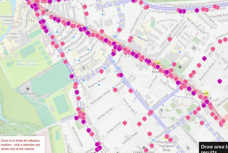
injuries on Cowley Rd, 2005-2019
more
Last Monday I needed to cycle with Helen from Cheney school, where she'd had a morning summer school session, to the county library in Bonn Square. The difficulties involved doing this - and planning it - illustrate just how hostile Oxford is for people who want to cycle and aren't able or willing to share with dense traffic flows. (My challenges cycling with an 8 year old are similar to those faced by less confident adults cycling by themselves.)
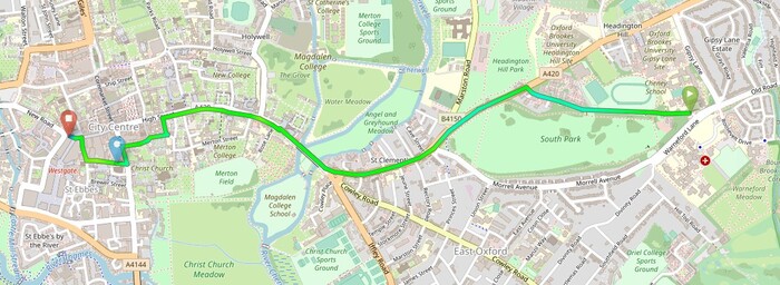
the direct route (3.2km)
more
The cycling infrastructure on Osney Mead, put in only this year (2021), is seriously dysfunctional.
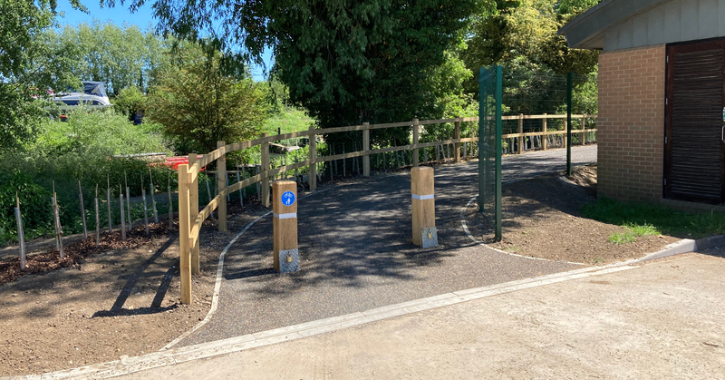
The bollards here seem almost deliberately placed to minimise usable space and create conflict between cycles, strollers, and even just ordinary pedestrians - why not one central bollard?
more
I was pretty critical of the plans for the Botley Rd rebuild, but at least for cycling the results from the first works to be completed seem even worse than I had feared.
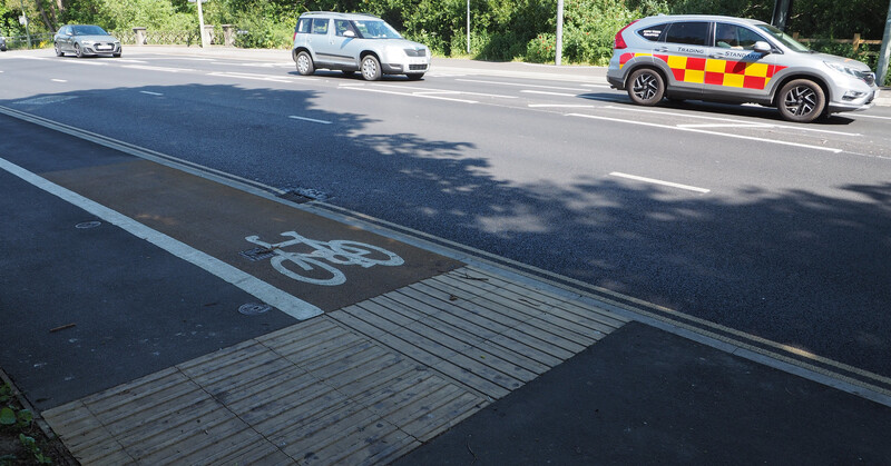
The cycle track here is just 1.25m wide and the footpath 1.45m — but room has been found for four lanes of motor traffic and some central hatching
The cycle lanes/tracks are too narrow - in places even narrower than the inadequate 1.5m that was promised. This is aggravated by the use of unforgiving full-height kerbing to the carriageway, which prevents easy overtaking and creates a serious hazard if something forces a swerve. The cycle tracks are often directly adjacent to narrow 3 metre motor traffic lanes carrying 30mph traffic — a pedestrian suddenly stepping into the cycle track, debris, or anything else, and someone cycling might be straight under a car or bus. And the cycle tracks lack consistent priority over side entrances and are not flat, going up and down over driveway entrances (where keeping very occasional vehicle movements smooth has been prioritised). more


